Alarka Falls
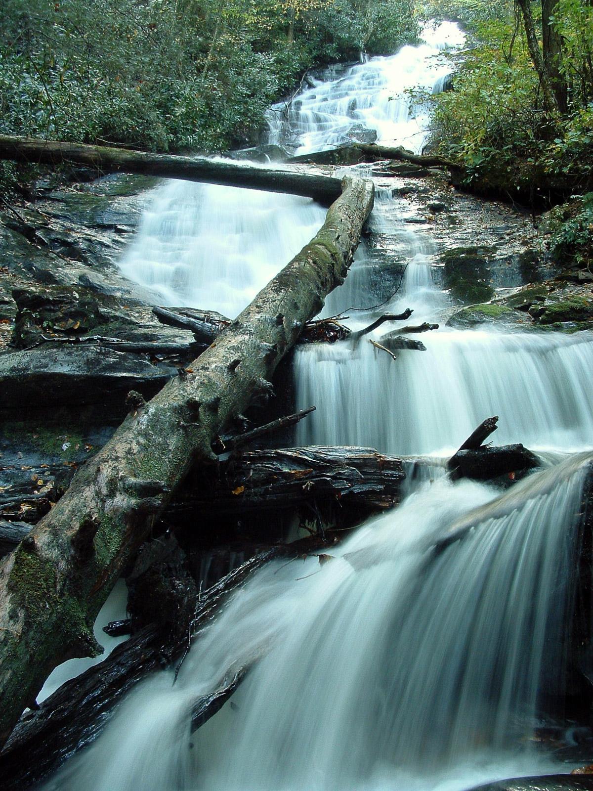
This is a long tumbling combination of cascades and slides, with a few free falling sections thrown in for good measure. On the whole, though, it's far from vertical. Lush woods surround the falls and nice green moss covers most of the rocks. It's kind of hard to take in from one vantage point and it's a lot higher than it looks in photos!
Statistics
- Height: 200 - 250 ft. (not all visible from the base)
- Elevation: 3630 ft
- Stream: Alarka Creek
- Landowner: Nantahala National Forest
- GPS: 35.338593, -83.371008
Hike Information
- Difficulty: Moderate
- Length: 1.0mi
- Tread Condition: Moderately Rough
- Climbing: Climbs Moderately (380 ft)
- Type: Out-and-back
Map
GPS Directions & Map
From Current Location or address:
Driving Directions
From Asheville, NC, take I-240 west to I-40 west and go 16.7 mi, past Canton. Take exit 27 for US Hwy. 19/23/74 west toward Clyde/Waynesville, the Great Smoky Mountains Expressway. Go 42.9 mi on the Expressway, past Sylva, Cherokee and Bryson City.
Take exit 64 for Alarka Road. Turn left at the end of the ramp onto Alarka Road. Go over the highway and after about 0.3 mi, turn right to stay on Alarka Road. From the right turn, it's just under 9 1/2 miles to the end of Alarka Road, where the road basically ends and the trail begins.
Note: It may be quicker to take Deep Gap Road, 4 miles after the right turn onto Alarka Road. Deep Gap Road comes back out on Alarka Road after 2.7 miles; turn right and continue to the end of Alarka Road from there. This bypasses a twisty gravel portion of Alarka Road and shaves about a mile off the total distance.
Alarka Road dead-ends just past an old gated forest service road on the right, and after a crossing of Alarka Creek, in a small turn-around. The road leading to the left is a private drive. Park in the turn-around without blocking the drive.
Trail Description
Two trails go upstream along Alarka Creek over Jeep mounds; they soon join together so take either one. It's a short hike on an obvious trail of just under 1/2 mile to the base of the falls. The trail gets pretty steep just below the falls and almost blends in with the creek in spots. There are also a few roots, rocks, logs to contend with, so it's moderately difficult overall.