Falls on Grogan Creek
Also known as: Grogan Creek Falls
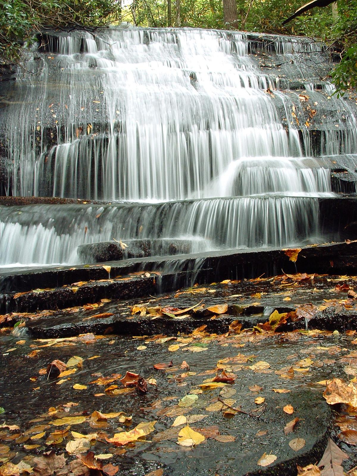
This trailside falls is small but pretty. The water flows down a mossy slide (which gets steeper near the bottom) in characteristic straight vertical streams, before spilling over some photogenic, knee-high ledges in free-falls at the very bottom. The surrounding forest is lush and green in all seasons.
Statistics
- Height: 20 ft
- Elevation: 2740 ft
- Stream: Grogan Creek
- Landowner: Pisgah National Forest
- GPS: 35.271919, -82.808606
Hike Information
- Difficulty: Moderate
- Length: 3.7mi
- Tread Condition: Moderately Rough
- Climbing: Climbs Moderately (450 ft)
Map
GPS Directions & Map
From Current Location or address:
Driving Directions
From the intersection of US Hwy 276 and 64 and NC Hwy 280 in Brevard, follow US 276 west for 5.2 miles. There are signs for Pisgah National Forest. Turn left onto FS 475, following signs for the Pisgah Center for Wildlife Education. The parking area is 3.9 miles ahead, on the right. (You will pass the Pisgah Center and fish hatchery at 1.4 miles, and the road turns to gravel at the parking for Cove Creek Falls).
Trail Description
Start following FS 475C from the south side of the parking lot, crossing a bridge over Cedar Rock Creek. Take the orange-blazed Cat Gap Loop trail to the right. In about 0.3 mi., cross a footbridge over Cedar Rock Creek, cross a gravel road, and continue the trail on the other side.
The trail passes above the weir for the fish hatchery, then begins winding along the slopes above the creek. As the trail starts approaching the creek again, you'll reach an area where you can hear the falls on Cedar Rock Creek to your left after another 0.5mi, at a campsite.
Continue past the campsite. Just past it, you'll enter the Picklesimer Fields area and reach the Butter Gap Trail junction. Turn right; pass through the fields and back into the woods. The trail begins following the lazy stream upstream through a flat area, then resumes its climb. In 0.5 mi you'll reach the junction with the Long Branch trail. Continue straight. After about another 0.4 miles, you'll reach the falls on the left. A short scramble path leads down to the base.