High Falls (Beech Creek)
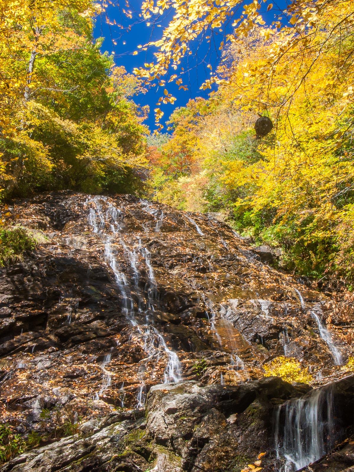
The creek can have a decent flow during wet weather, but it spreads out wide across this bumpy rock outcrop, forming lots of little falls over the mini ledges and giving it lots of character.
Statistics
- Height: 150 ft
- Elevation: 3997 ft
- Stream: Beech Creek
- Landowner: Nantahala National Forest
- GPS: 35.014814, -83.527937
Map
Driving Directions
From the intersection of US Hwys. 441 and 76 in Clayton, GA, travel west on US 76 for about 8 miles. Turn right on Persimmon Road. Go 4.1 miles and bear left on Tallulah River Road. There are signs for the National Forest & Campground. Follow this road for 7.5 miles through National Forest property along the river and, later, the small rural community of Tate "City". The road turns to gravel, and re-enters North Carolina. After re-entering the National Forest in NC, the Beech Creek trailhead parking is on the left - park here.
Trail Description
The hike to the falls is difficult and about 5 miles (round-trip) in length. The Beech Creek trail starts across and back down the road a bit; start the hike there. The trail climbs steeply up the ridge through a series of switchbacks. Follow the switchbacks rather than the steep, eroded shortcut trail going straight up the mountain. The trail will crest the ridge and start descending again - steeply at one point - to reach Beech Creek.
Cross Beech Creek. It may be possible to rock-hop here, or you may have to get your feet wet in higher water, and it will be impassable in a flood. Here you're in a dying or dead former hemlock forest. Pick up the trail leading upstream and away from the creek on the other side. The trail merges with an old roadbed shortly; bear left. You'll cross a few smaller tributary streams that might be dry, and then cross the creek in Bull Cove which should have water in all weather. This crossing is much larger and has a deep pool above the rock-hop area at the edge of the old road bed. On the other side of the crossing is an trail heading upstream along the creek. You can follow this a few hundred yards for a side trip to the falls in Bull Cove if you wish.
Continue along the old road bed, passing a rusty old gate. The road descends to the creek and crosses it a second time. After this, the trail begins climbing steeply and relentlessly with the scenic creek on the right. During very wet weather, a few side streams may form small waterfalls on the left. You'll cross a couple of landslide scars from events that occurred during the flooding in 2004, from the remnants of hurricanes Frances and Ivan. The trail has been re-constructed in those areas.
You'll pass an old rock wall structure on the left, and the trail enters a left hand switchback just beyond. The trail makes another hairpin to the right, and then another back to the left. At this second left-hand switchback, there may be a sign pointing to High Falls. Take the trail leading straight off the end of the switchback toward the creek. This follows an old road bed for a short distance and then the trail descends steeply to the creek. Follow the path/creek upstream a few hundred more feet to reach the base of the falls.