Catawba Falls
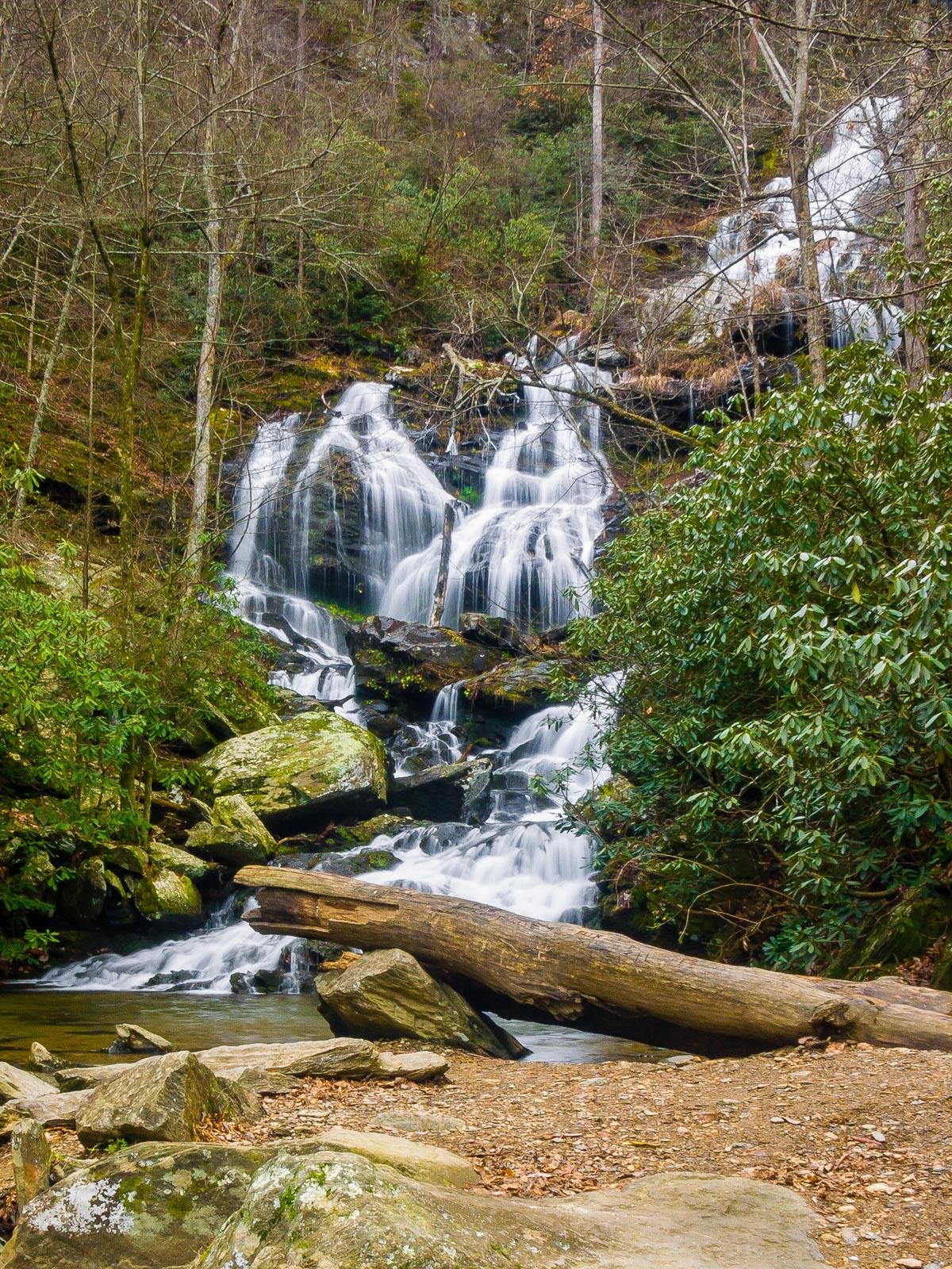
This is a high, wide series of cascades, best viewed in higher water after the leaves have fallen. Several free-fall sections are combined with rock-hugging cascades giving the falls plenty of variety and character.
Statistics
- Height: Over 100 ft
- Elevation: 1925 ft
- Stream: Catawba River
- Landowner: Pisgah National Forest
- GPS: 35.604338, -82.245034
Hike Information
- Difficulty: Moderate
- Length: 2.4mi
- Tread Condition: Moderately Rough
- Climbing: Climbs Moderately (345 ft)
- Type: Out-and-back
Map
GPS Directions & Map
From Current Location or address:
Driving Directions
From Asheville, take I-240 E to I-40 E. Go just under 20 miles on I-40 to exit 73, the second Old Fort exit. Before the ramp ends, turn right onto Catawba River Road. Go 3 miles to the bridge at the end of the road. The new, large parking area is just across the bridge.