Picklesimer Rock House Falls
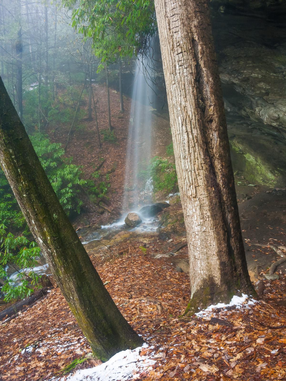
A small stream flows over an overhanging bluff, forming a nice free-fall. You can easily walk behind the falls and even under them in warm weather. Large trees and rhododendron grow in the area and overhang the bluff. There are some tiny cascades below the main drop. A large alcove under the bluffs gives this falls its name - old timers used to call these bluffs "Rock Houses". Presumably, someone named Picklesimer lived nearby.
Statistics
- Height: 40 ft.
- Elevation: 2679 ft
- Stream: Tributary of Abes Creek
- Landowner: Nantahala National Forest
- GPS: 35.018535, -83.253493
Map
Driving Directions
From the intersection of US Hwy. 64 and NC Hwy. 28 in downtown Highlands, go south on NC 28 for 5.9 miles. Turn right onto Blue Valley Road (S.R. 1618) and go 4.2 miles to the trail parking.
Blue Valley Road changes to gravel, crosses the creek and becomes F.R. 79. At about 3 1/2 miles from N.C. 28, make sure to bear left at the sign board. The best spot to park is on the left in a narrow pull-off opposite an old logging road leading up to the right.
Trail Description
The trail is moderate and about 1.2 miles round-trip. Just follow the old logging road to where it ends at a creek, turn right, and follow a faint path about 400 feet to the falls.
The old road is gated a few yards from F.R. 79. It ascends on a moderate course through a stand of white pines. After crossing a low ridge it descends, again not too steeply, into an wildlife clearing. On the other side of the clearing is where the road ends; don't cross but go upstream on the faint path, which twists through some rhododendron and crosses a couple of seeps. It's not terribly rocky, rooty, or steep, so families with older children should be easily able to make it to the falls.